Photo by Debra Ferguson/Southern Images
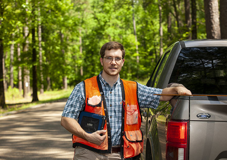
Mississippi Land Bank appraiser Garrett Dismukes uses a time-saving mobile app for forest inventories.
Photos by Debra Ferguson/Southern Images
Mississippi Land Bank appraiser Garrett Dismukes uses a time-saving mobile app for forest inventories. The more uniform the timber stand, the fewer samples the app needs to calculate its value.
Rural appraisers will go a country mile to figure out what your property is worth.
They’ll drive across state to measure buildings, estimate crop values, and count livestock and equipment.
They’ll brave snakes and all kinds of weather to inventory trees in a timber stand.
And they’ll figure out property value based on various factors — type of agriculture, nearest city, ducks flying overhead or oil flowing underneath.
Today, rural appraisers can do all that faster and more accurately thanks to technology. As a result, borrowers and lenders now have a better idea of their property’s market value — including the collateral backing their loans.
“Appraisals help protect the association, our district and the entire Farm Credit System,” says Tyler Mullins, vice president and appraiser for Mississippi Land Bank. “We can look at how well secured the collateral portfolio is, which helps insulate us during economic cycles.”
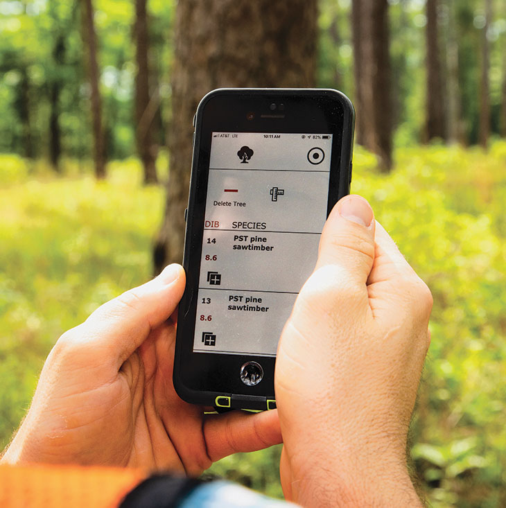
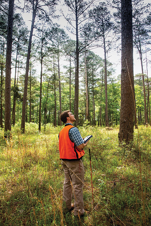
Photos by Debra Ferguson/Southern Images
Dismukes records the species, height and diameter of every tree on a percentage of the property using the Forest Metrix app.
Seeing Things in a New Way
Appraisers try to figure out what a potential buyer would pay for a property based on its physical attributes. Things like water, tree cover, topography and configuration make a difference.
Today’s detailed aerial photos show what makes property more or less desirable. And multilayered maps show property boundaries, flood zones, easements, soil types, school districts and more.
What appraisers can’t inspect on the ground, they can see from a drone.
“We’ve been using a commercial drone in West Texas, where there are sections of land that you can’t drive to,” says Stan Phillips, director of appraisal and a regional vice president for AgTexas Farm Credit Services.
Top 10 Technologies for Rural Appraisers
- GPS coordinates for pinpoint accuracy
- Geographic information systems (GIS) that display data in layered maps and 3-D scenes
- Up-to-date aerial photographs and property maps
- Mobile hotspots for access to appraisal websites on the road
- Mobile apps that track your location without a cellular signal
- Apps that calculate timber’s value with less time and footwork
- Drones that get a bird’s-eye view of inaccessible areas
- Software for reporting appraisal information and comparing similar properties to arrive at a value
- Databases of accurate sales information gathered by Farm Credit appraisers and automation
- Market trend reports from the Texas A&M University Real Estate Center that are based on Farm Credit sales data
Having Data When and Where You Need It
Software and automation now put sales information at appraisers’ fingertips.
When a Farm Credit real estate loan closes, the sales price, legal description and other details automatically go into the lender’s sales database. Appraisers then use this data plus sales information from a large broker network to look at market trends and compare properties.
“It lets them work smarter instead of harder,” says Brad Swinney, vice president of collateral risk management for Farm Credit Bank of Texas, which provides the services to associations.
Mickey Nixon, a Capital Farm Credit regional chief appraiser in Texas, says the tools let appraisers write well-supported reports quickly — with fewer errors and greater confidence.
“Technology’s touched every aspect of our business,” Nixon says, citing the benefits of appraisal software, comparable sales data and up-to-date maps and images.
Doing Things No Machine Can
“I think what separates a rural appraiser is the sheer volume of information,” says Troy Peters, senior appraiser at Southern AgCredit in Mississippi.
And that’s where technology comes in. It frees appraisers to focus on what they do best: understand an immense variety of rural property and agriculture.
– Staff